My Store
Bute & Arran - Historic Map of Arran
Bute & Arran - Historic Map of Arran
Couldn't load pickup availability
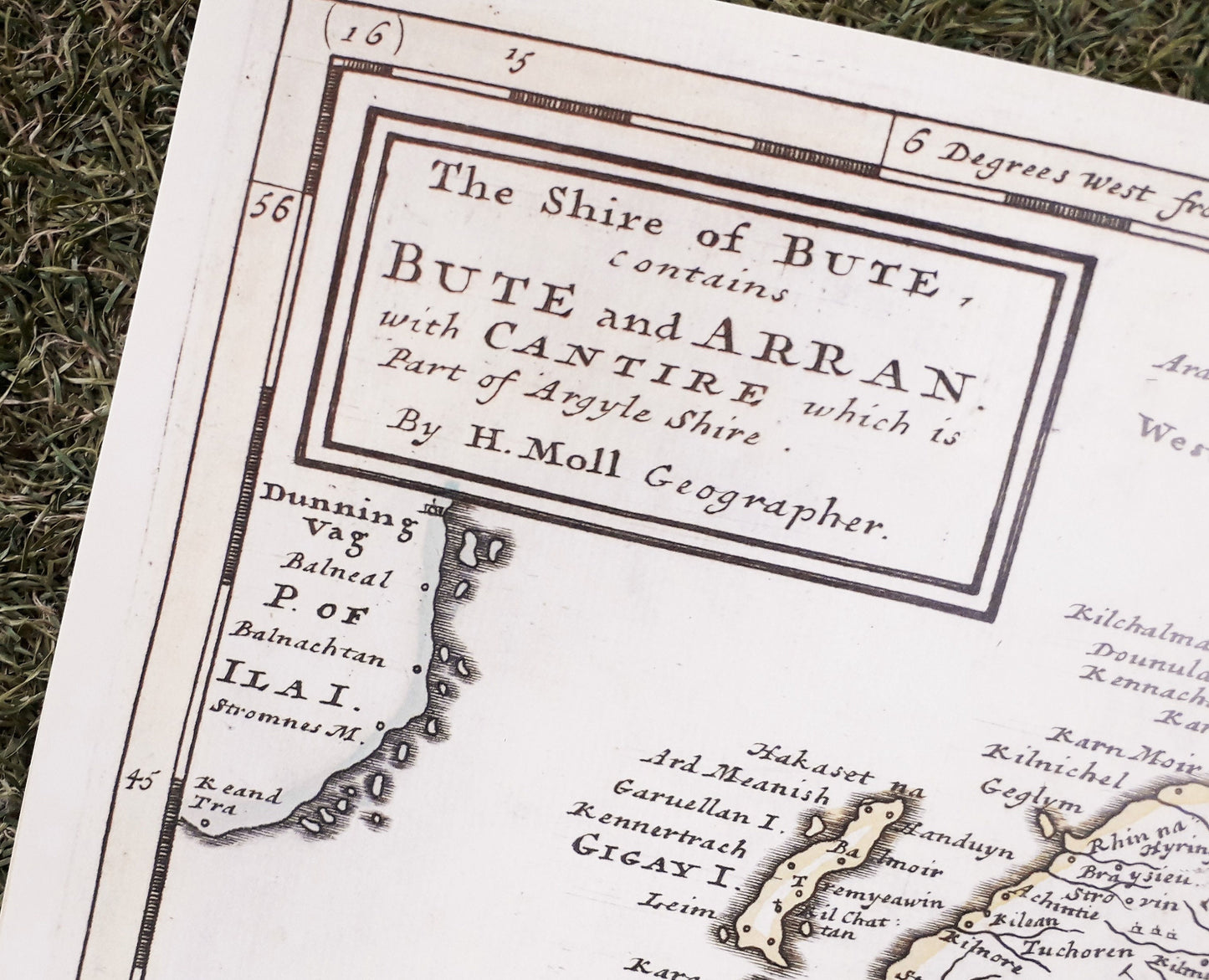
Add interest and a talking point to your décor with these historic maps depicting Arran. Beautifully printed on 250gsm silk finish paper these maps show the mapping of Arran through the years and the interesting spelling of placenames and features.
Bute and Arran shows the Isle of Arran as seen by ‘H. Moll Geographer’ (1654-1732) and is inscribed with many recognisable place names such as ‘Frith of Clyd’, ‘Loch Rensa’, 'Campeltown', ‘Loch Terbart’,and ‘Rothesay’. It is also interesting that Mr Moll felt it important to mark in what is now the South Arran Marine Protected Area that ‘Here is Plenty of Cod!
Available as an A3 or A4 print - Postage from the Isle of Arran is included. Should you prefer to click and collect from A Touch of Enchantment at Cladach please contact us for price adjustment.
A3 map delivered rolled in postal tube.
A4 map delivered flat in envelope.
Check our other listings for other Arran maps and gifts.
Share